
At the corner of Cliffe and South Street, you can veer right and wander toward the Snowdrop Inn for a pint, or take a left and make your way toward the Dorset. If you aren’t in search of an English ale, and the weather has been dry enough for a walk without wellies, you can also choose to continue on across the road where a narrow path sharply curves out of site.
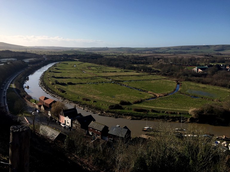
This is the starting point for one of my favorite countryside walks in Lewes, England. Chapel Hill is aptly named and incredibly steep for a road. Cottages and terraced houses are tucked along the edges and, where the trees are still thin from the winter weather, you can take in views of the River Ouse and Lewes Castle far below. Although the road is quiet and picturesque, it’s no easy stroll.
It’s at this initial stage of my morning walk the hill acts as a reminder to occasionally lay off the sausage and mash dinners. I’m working to keep my breathing under control, but it feels good to be outside and the excursion is keeping me warm.
A brisk walk can be a remedy for so many agitations. The alchemy of cool air, long views and the contracting of muscles calms my monkey brain. Sometimes, all I need is to get out of my head and into my body to recalibrate my sense of perspective. Twenty minutes later, the English town I now call home is far below me. My Fitbit says my heart rate is up to 126, and my burning thighs verify it was one hell of an incline.
England’s Rights of Way
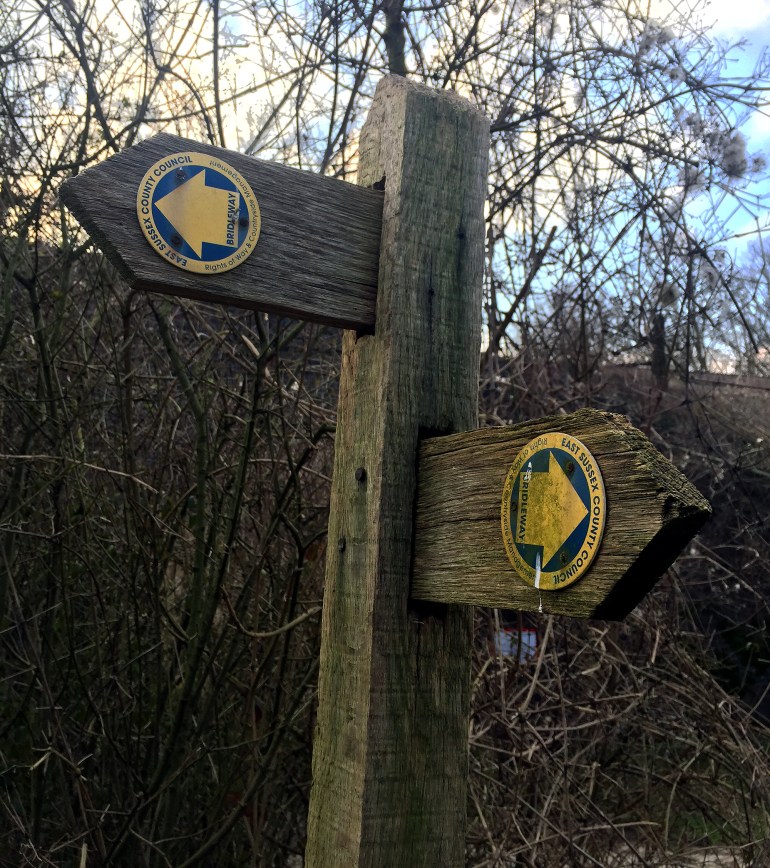
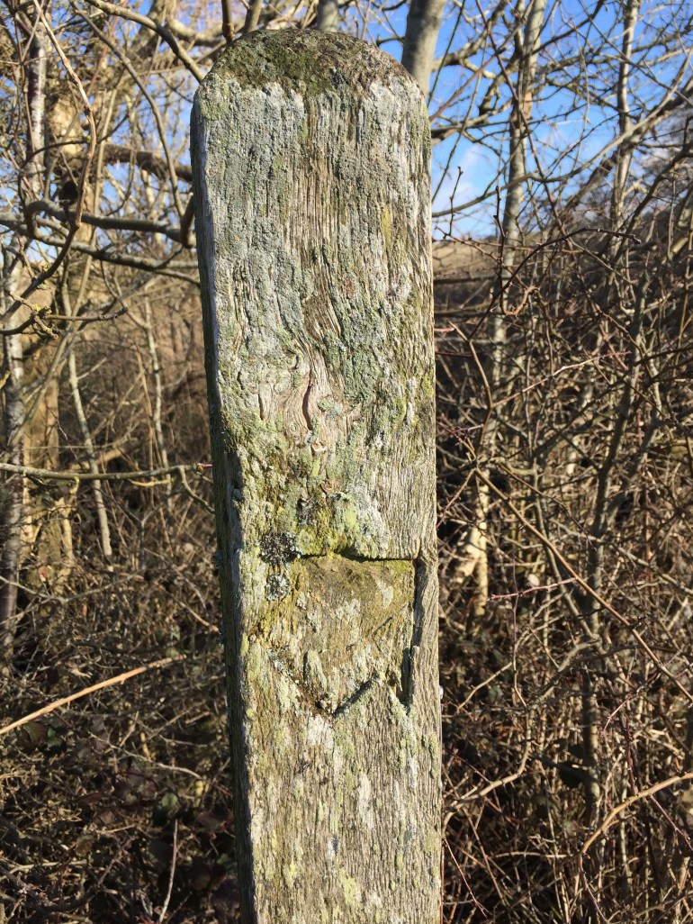
Following the arrowed markings, I take a left at the top of the hill where the footpath hugs the outer edge of Lewes Golf Course. On windy days, when the gusts coming up from Brighton and Newhaven’s coast are relentless, your ears are filled with white noise. On the calm days though, birds chatter and the occasional high-pitch “clink” of a driven golf ball can be heard in the distance.
Despite the manicured greens of the private golf course, the path I’m wandering is open to the public. Thanks to the Rights of Way law in England, it’s legal for me to “pass and repass along the way. You may stop to rest or admire the view, or to consume refreshments, providing you stay on the path and do not cause an obstruction.”
I think it’s nice they are specific about taking in a good view while celebrating with a refreshing beverage.
These footpaths crisscross all of England. I’ve even traversed one that cut a solid scar straight through a wheat field. As my husband said when I questioned this route; “it’s our right.”
A Walking Path from a Fantasy Book Setting
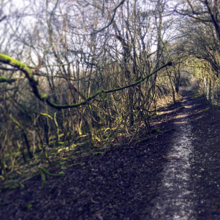
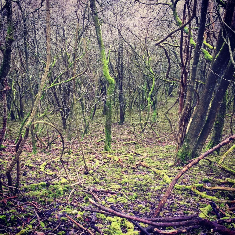
The path continues alongside the mowed grasses of the course and curves back toward the east, until finally, a wooden gate signals the entrance into new terrain. I’m sheltered from the cold wind by the thin, outstretched arms of the trees and a few birds warn of my intrusion.
Each time I enter into this tree tunnel along the walking path, I’m whisked into another world. It’s the moss-covered woodland of my childhood fantasy books. Being alone in this glowing green patch of the trail is also tinged with a slight sense of anxiety. It’s not a sort of fear to ruin the peaceful setting, but it’s enough adrenaline to keep me from being complacent about my footing on the slick mud or alert to anything out of place. Still, I find myself daydreaming as I peer into the tangle of branches.


These long walks are also motivating me to learn more about the East Sussex setting rather than be a passive observer. Maybe it’s a way to find my footing in a new home and country, similar to my need to know which way is north when I arrive at unfamiliar place.
Perhaps, learning the names of trees and plants is a yearning for establishing roots of my own with the bonus of knowing which vegetation is edible and medicinal should a zombie takeover force us into the countryside. Whatever the reason, I’ll have to wait until Spring when the leaves appear to test my knowledge (which at this point is laughable.)
A Well-Earned View of Lewes

The exposure to the wind shakes me from my deep internal dialogue about bird names and wild foraging and I step into the expanse of grass along the ridge of the hill. This is my half-way point and I’m rewarded with an epic view of the English countryside.
A bench is perched at this lookout point and when it isn’t soggy from the rain, is a great spot to take in the panoramic view. Being this exposed to the wind can make even a sunny day uncomfortably chilly, but I’ve learned from past mistakes and remembered my mittens. Despite the staccato gusts, I settle into the view and enjoy a treat of chocolate before carrying on down the hill.
The footpath makes a “U” shape around the steep ravine and sheep graze along the hillside, along with the occasional handful of cattle. They seem pretty unimpressed with walkers, but it’s always good to pay attention to both the temperament of the animals and the piles of crap that dot the trail.
A worn line of trampled grass leads you gently down toward the foot of the hill and alongside the back garden fences of Lewes’s South Malling neighborhood. Once, I followed the muddy trek to the very bottom and was surprised at its abrupt end, thanks to the zooming cars on the A26. This is the quickest way back to Cliffe High Street, but it’s a less than ideal way to end a peaceful walk.
If you want to ease back into the hustle and bustle of the town, it’s best to take a sharp right off the path and through a quiet street toward Mill Road. You can cross at the lights and carry on down Church Lane, past the Sussex Police Headquarters and then down toward the park. The quiet stroll along the River Ouse is a welcome homestretch.
Tips and Trail Route
I’m not sure if there is an official name for this footpath, so the “Lewes Golf Course Walk” is my most sensible and uncreative title. The loop is pretty straightforward, and because it is one of the quicker routes, food and water aren’t necessary (unless you are like me and your blood sugar drops at inconvenient times and makes you a lunatic).
Distance and Timing:
The total distance for this route is around 3 miles, but the timing will depend on walking pace and how long you want to stop and enjoy the views.
- Fast/this is my workout for the day pace: Around 1 hour and 15 minutes starting and ending around the bridge on Cliffe Street in Lewes, England.
- Leisurely/daydreaming and enjoying refreshments on the rights of way: Up to 2+ hours
What to Wear:
Sunny days can be deceiving, and the weather can change quickly from cloudless skies to rainy so check the forecast so you aren’t exposed on the hilltop. My fingers go numb when it’s 50 degrees Fahrenheit and below, so I’m always carrying gloves, but depending on the season I recommend wearing a hat and layers to be comfortable at all stages of the walk.
I’ve walked this footpath in hiking boots and in regular running shoes. Both experiences were fine, although keep in mind the paths are steep and the trail in the woodland section and the final decent back into Lewes can get slippery and muddy.
Food and Refreshments:
This is a shorter walk so chances of getting dehydrated are minimum, unless you are walking this hungover and then get lost along the way. I always carry nuts or chocolate because I’m paranoid of getting “hangry” but packing provisions for this walk isn’t necessary.
There aren’t any pubs or places to stop for the toilet until you near the end of the walk. There is a Tesco’s near the river in the final stretch that has a Costa’s Coffee and facilities.
Be Prepared for Animals:
The second half of this path cuts through grazing areas of sheep and sometimes cattle. If you are walking with a dog, keep it on its lead and you shouldn’t have any problems. These animals see walkers all the time and aren’t really impressed. The biggest danger is stepping in piles of poop, so keep your eye to the ground.
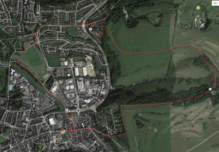
Amateur Drawing of Walking Trail for Reference:
Here’s a very rough outline of the trail for reference. This is not an official map and don’t claim to offer the most informed route so use at your own risk. The start and end points are at the bridge on Cliffe High Street in Lewes.
Have you done this walk, or have any suggestions for footpaths to check out in the East Sussex area? I’d love to hear from you!
